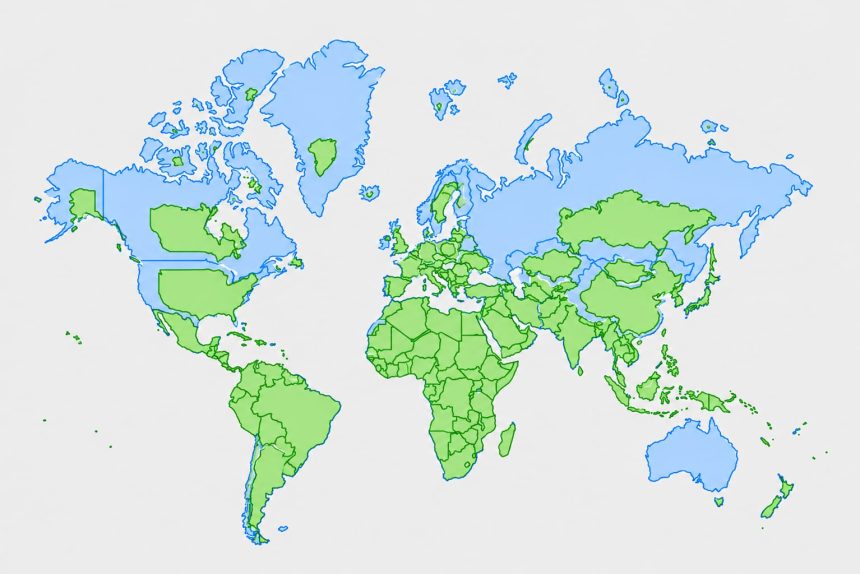
A new world map could change how Africa’s size is represented following the adoption of the “Correct the Map” resolution by the United Nations General Assembly.
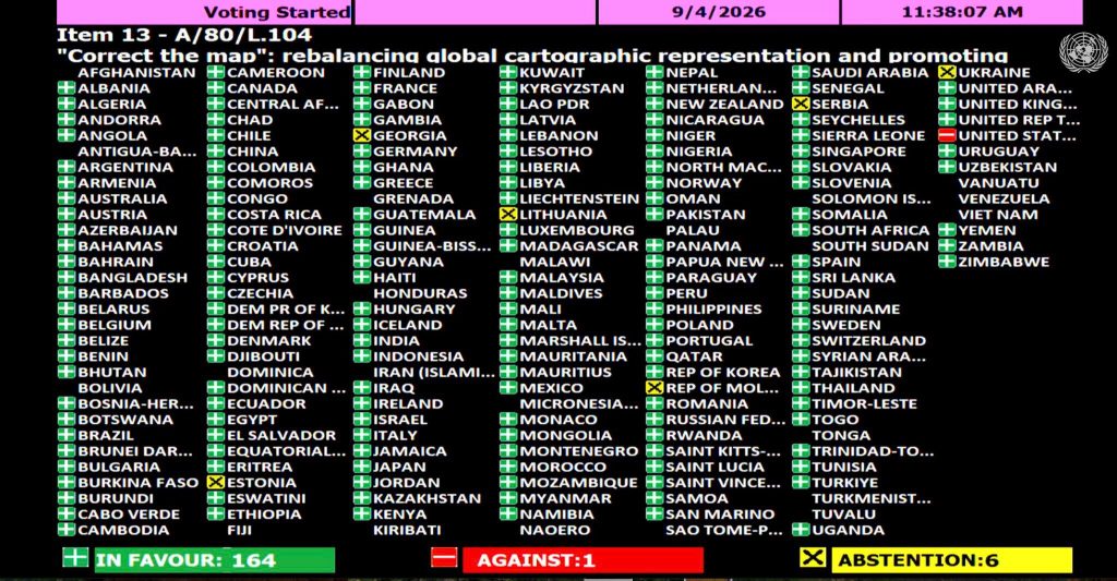
The resolution, sponsored by Togo on behalf of the African Group, was adopted by the General Assembly with 164 countries voting in favour.The United Stated voted against it, while six countries abstained.

The initiative seeks to promote the use of maps that more accurately represent the relative size of continents, including Africa, which appears considerably smaller on the widely used Mercator projection.
The Mercator projection was developed in the 16th century by Flemish cartographer Gerardus Mercator for navigation. While it is useful for showing direction, it distorts the relative size of land masses, with areas farther from the Equator appearing larger.
As a result, Greenland can appear almost comparable in size to Africa on a Mercator map, despite Africa being about 14 times larger in actual land area.
However, the resolution is not legally binding and does not mean the Mercator map will immediately disappear. Instead, it encourages countries and institutions to consider more accurate alternatives, particularly when maps are used to compare the size of regions.
The Mercator projection also remains useful for navigation because of the properties for which it was originally developed.
Why is this important for Africa?
According to the African Union (AU), the continued use of maps that do not accurately show the relative size of continents has implications for how Africa is represented globally.
The continental body says more accurate maps can ensure Africa’s geographical size is properly represented in schools, textbooks, media and digital platforms.
AU Commission Chairperson Mahmoud Ali Youssouf welcomed the resolution, describing its adoption as an important step towards fairer and more accurate representation of Africa and other regions.
Youssouf said the initiative goes beyond cartography and called for Africa to be represented based on objective and scientifically established realities.
“Africa must be represented as it is, in true dimensions and rightful place in world,” said Youssouf
As part of this effort, the AU has endorsed the Equal Earth projection, an equal-area map that preserves the relative size of land masses more accurately than the Mercator projection.
The continental body is calling on international institutions, education systems, publishers and digital platforms to progressively adopt maps that provide a more accurate representation of the actual size of the world’s regions.
“The Chairperson encourages international institutions, educational systems, publishers and digital platforms to progressively promote the use of cartographic representations that more accurately reflect actual land areas,” the AU said in a statement.
The practical impact of the initiative will now depend on how governments, schools, publishers, international organisations and digital platforms respond to the resolution.