Kenya has taken another step towards developing its first National Marine Spatial Plan (MSP) following a series of stakeholder validation meetings being held across the five coastal counties of Kilifi, Kwale, Mombasa, Lamu and Tana River.
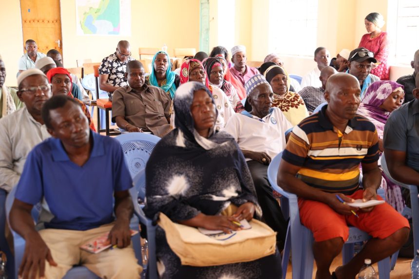
The validation exercise that brought together representatives of coastal communities, county governments, civil society organizations, the private sector, national government agencies and other stakeholders reviewed and validated proposals that will form part of the Draft Marine Spatial Plan.

“The stakeholders met to confirm that the issues they presented during previous consultations had been addressed in the plan proposals. They also gave feedback on how the planned proposals impact them suggesting mitigation measures.”
The Marine Spatial Plan is a 20-year framework designed to guide the sustainable and integrated use of Kenya’s approximately 250,000 square kilometres of ocean space. The plan seeks to balance economic development, environmental conservation and social interests while reducing conflicts among different users of marine and coastal resources.
Following publication of the Intent to Plan in January, 2025, a draft Marine Spatial Plan has since been prepared following extensive technical studies, data analysis and stakeholder consultations conducted over the past year.
In line with the principles guiding the preparation of the MSP, particularly the principle of stakeholder participation, which promotes inclusivity, transparency and shared ownership, the State Department for the Blue Economy and Fisheries, in collaboration with its technical partners, has convened the second series of stakeholder engagement forums across the five coastal counties.
The engagement process aimed at ensuring that the draft plan “accurately reflects stakeholder views, available scientific data and the diverse interests of ocean users while providing a shared vision for the sustainable development and management of Kenya’s marine space.”
Stakeholders including Islam Abdallah from Kipini in Tana River County, the MSP has come at a time when they needed order so that there is a win-win situation in the utilization of marine resources. “We are supporting the MSP, we know that the ocean belongs to no one, and with this plan we want when it is implemented, consider the locals in Kipini first who should benefit from the MSP,” said Islam in an interview at Minjila in Tana River County.
For Saida Azur Idris a member of the Beach Management Unit (BMU) and the Chairperson of Tuna Women Group, the Marine Spatial Plan is an idea that has come at the right time, it is important because it is aiding in the planning on how to utilize the ocean sustainably, “they have shown us how the industrial fishers will ensure they do not interfere with the artisanal fishers to avoid conflicts,” she noted.
According to Mwanajuma Hiribae the County Executive Committee Member (CECM) in charge of Lands, Agriculture, Fisheries, Livestock development, the MSP when implemented will help reduce resource-use conflicts, protect marine ecosystems and enhance benefits to local communities.
“It is an important exercise as it is a dream that we have been yearning for, for a very long time, as residents of Tana River, the ocean has not been seen as being of value, except for the communities that live within Kipini area Ozi and Chara, but after the stakeholder engagements began, on issues dealing with the Blue economy, our people have begun to see the importance blue economy together with the green economy,” she noted.
Marine Spatial Planning is an internationally recognized process that helps governments and stakeholders decide how marine and coastal resources can be used efficiently, safely and sustainably. It provides guidance on where different activities such as fishing, tourism, shipping, conservation, energy development and marine infrastructure can take place while protecting critical ecosystems and supporting economic growth.
The Marine Spatial Plan is expected to strengthen governance of Kenya’s marine resources, support sustainable blue economy growth, protect marine biodiversity and provide a clear framework for future investments and development activities in the ocean space.
Development of the MSP is spearheaded by the Ministry of Mining, Blue Economy and Maritime Affairs through the State Department for the Blue Economy and Fisheries, in collaboration with other government agencies relevant to the blue economy. The initiative is supported by the Government of Kenya and the World Bank through the Kenya Marine Fisheries and Socio-Economic Development (KEMFSED) Project.