
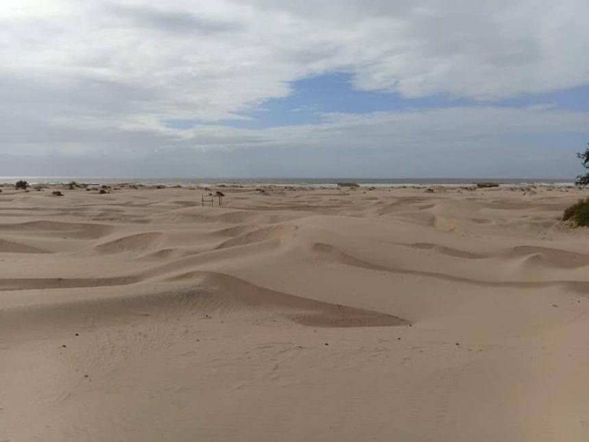
To see what upstream water management looks like, I travel inland to Wote, the headquarters of Makueni County, about 414 kilometres by road from Mambrui. Water scarcity has long shaped life in Makueni, where unreliable rainfall and recurring drought threaten livelihoods. The county’s 2024 Participatory Climate Risk Assessment, published by the Makueni County Government, identifies drought as a major climate-related hazard, alongside flash floods and strong winds.
These hazards threaten water supplies, crop and livestock production, and household incomes. In its February 2026 bulletin, the National Drought Management Authority reported that households travelled an average of 4.6 kilometers to access water. In areas where people depend on both crop farming and livestock keeping, the average distance was even longer, at 7.8 kilometres.

Joseph Kioko, the Makueni Civil Society County Coordinator, describes a local approach to deal with the challenge of water scarcity in the County.
“We have a lot of sand in Makueni, actually the best quality in the country,” he says.
“When we conserve this sand, we find that the water table will rise, which encourages agriculture and the availability of water in many households.”
Construction of sand dunes
In Makueni County, there is the construction of sand dams which help communities capture and store water in seasonal river channels.
The Makueni Sand Conservation and Utilisation Authority set up in 2015 has built 26 sand dams across 13 wards, turning degraded riverbeds into productive ground. Working with development partners, the county has supported the construction of more than 1,000 sand dams, improving water availability, supporting irrigation and strengthening communities’ resilience to drought.
“I was raised in Mikauni Village, where we used to rely on the Londokwe River before any sand dams were built,” Kioko recalls.
“First, the sand dam acts as a bridge; as sand accumulates, it buries the gully and makes the river passable. Second, it helps raise the water table. Previously, we used to fetch water 8 to 14 kilometers away at the Athi River. Now, we just dig shallow wells and access water right in our village.”
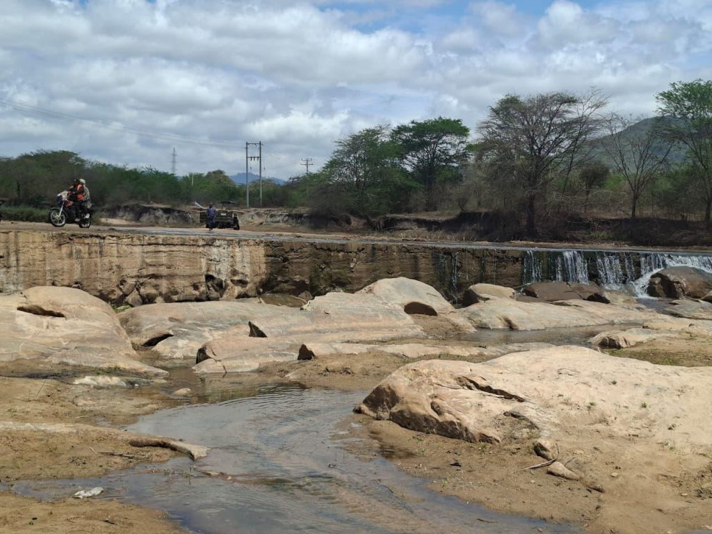
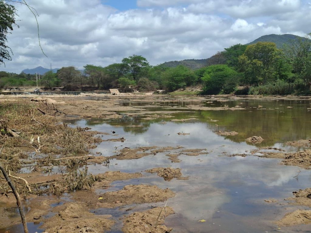
In Wote, one such sand dam crosses the Kaiti River, which joins the Thwake dam and then the Athi River. Utooni Development Organisation built it with the Kaiti River self-help group in August 2013. It serves Wote town and neighbouring communities and can store 34,390 cubic metres. Downstream, along the river, farmers pump water from the shallow stores to irrigate their crops. They say the dams now let them farm year-round, even through severe dry seasons.
Maintaining the sand dams
Makueni County has turned sand from a free-for-all into a regulated resource. Justus Mutuku, is a resident who works with the Makueni Civil Society Organisation.
“We have an Act passed by the Makueni County Assembly in 2015 establishing the Makueni County Sand Conservation and Utilisation Authority, which is mandated to regulate the utilisation and management of sand, especially for commercial purposes,” he explains.
Under the Act, Community committees oversee soil conservation and sand harvesting while commercial sand harvesters must be cleared by the Authority, which issues license for specific tonnage, and monitor for adherence so that they do not falter and alter river courses. Illegal harvesters face prosecution.
Mutuku points to another conservation challenge: rivers do not stop at county boundaries.
During the rainy season, stormwater flowing from Kajiado County into Makueni carries heavy sediment, adding to the pressure on the river system.
Creating a balance
At the Sabaki, the problem is too much sediment. Elsewhere along the same system, it can be too little.
The estuary’s challenges tell only half the story. According to the Sabaki Estuary Management Plan 2023–2028, sediment carried by the Athi-Sabaki River has increased from about 50,000 tonnes annually in the 1950s to between 5 and 13 million tonnes in more recent estimates, largely due to poor land-use practices upstream.
This growing sediment load threatens the estuary’s ecological balance, with sediment accumulating in its mudflats and affecting mangrove habitats.
Kimeli observes that most of the sediment that builds coastal zones originates upstream and large hydroelectric dams trap much of it.
“When most of this sediment is held back, it affects the supply to the coastal strip, hindering the growth of sand dunes and harming coastal habitats like mangroves,” he warns.
He points to measures that are usually taken to prevent dams built upstream from depriving the coast of sediments. They include periodically removing accumulated sediment from dams to allow it to move downstream, as well as maintaining what is known as environmental flows during dam construction and operation. These flows help ensure that water continues downstream, keeping the river closer to its natural state.
The aim is to balance communities’ need to store water with the need to maintain the natural flow of water and sediment that supports downstream ecosystems. However, a key question remains: how much water and sediment must be allowed to flow downstream to protect the coast, and how can balance be achieved?
Kimeli says the Athi–Galana-Sabaki River system is a major source of sediment for the coast. Research by geologist J. O. Z. Abuodha, published in 2003 found that Sabaki River sediments dominate the Malindi Bay coastline and supply sand that is later carried into the dunes by waves and wind.
Too much sediment can also destroy mangroves. In a 2002 study published in a peer review scientific journal known as Ambio, researchers Johnson U. Kitheka, George S. Ongwenyi and K. M. Mavuti of the Kenya Marine and Fisheries Research Institute examined sediment movement in Mwache Creek, near Mombasa. They found that heavy rains during the 1997-1998 El Niño brought large amounts of soil into the creek, depositing an estimated one million tonnes of sediment which caused extensive destruction of mangroves in the upper creek. Today with the vagaries climate change pose, one cannot tell what will happen next.
Dams can trap sand reducing the amount of sediment flowing downstream to the coast while providing water to communities facing water shortages. This can help prevent coastal habitats from being buried under too much sand.
However, when the dams trap too much sediment very little reaches the coast, leaving these habitats without the sand they need to remain healthy and support marine life. It also reduces the supply of sand available to form and sustain coastal dunes. This creates a delicate balance: too much sediment can harm coastal habitats, but too little can affect marine life and the natural formation and movement of sand dunes.
The solution, Kimeli says, lies in sensitising communities to respect riparian zones and allowing rivers to maintain their natural ecosystems.
Kenya’s Water (Resources) Regulations, 2025 provide for a riparian reserve of at least 10 meters on either side of a watercourse, or the full width of the watercourse, whichever is greater, up to a maximum of 30 metres. These protected areas are intended to safeguard water resources and regulate activities along riverbanks. Kimeli says communities also need to understand that activities upstream can have consequences for people and ecosystems downstream.
Role of County Government
Back in Kilifi, the county government is putting money and structure behind the community effort. Mary Kabani, the County’s Tourism Director, says the main strategy is to organise residents into active conservation groups. Through CBOs like SARICODO, local groups work within defined zones to protect the environment while earning a living.
The County raises modest revenue through single business permits, about Ksh. 6,000 for small kiosks and Ksh. 20,000 to 30,000 for zip-liners, and is developing formal regulations to make that revenue sustainable.
Protecting the dunes, Kabani says, will take many hands, including the national ministries of tourism, agriculture, the blue economy, fisheries and environment because among other benefits the dunes have substituted unregulated sand harvesting by providing youth with a source of living.
Looking beyond Mambrui
Mambrui is not alone in confronting the challenge of shifting sand. In other parts of the world, communities have tested practical ways of slowing moving dunes, offering lessons that could help inform Kenya’s coastal conservation efforts.
In Mauritania’s capital, Nouakchott, sand encroachment is known to threaten settlements and infrastructure. Efforts to control it have included the rehabilitation of the protective belt of trees and shrubs around the city, using physical barriers to slow the movement of sand and planting vegetation to help stabilise the dunes.
A 2010 publication by the Food and Agriculture Organisation (FAO), titled Fighting Sand Encroachment: Lessons from Mauritania, shows these efforts. The approach combines mechanical measures, such as sand fences, with biological methods, including planting trees and shrubs and protecting them as they establish themselves. The idea is to reduce the force of the wind near the ground, trap moving sand and give vegetation a chance to grow.
In China’s Inner Mongolia region, researchers have tested another practical technique known as Straw Checkerboards. Here, workers press straw into sandy ground in a grid pattern, leaving sections exposed above the surface. These small barriers slow the wind and trap sand, creating conditions that help plants establish themselves.
A study published in the Journal of Arid Environments in 2004 compared dunes where researchers installed straw barriers and planted drought-resistant shrubs with dunes left to recover naturally. During the first two years, the researchers found that the areas where these methods were applied showed improvements in vegetation cover, plant growth and the variety of plant species compared with areas left to recover on their own.
These examples show that managing moving sand does not always mean trying to remove it. In some settings, the approach is to slow its movement and encourage vegetation to hold the surface in place.
Upstream to the Coast, communities take charge
The wind continues to blow across Mambrui, moving the sand dunes of Dubai Ndogo as it has for generations. But today, young people are stepping up to protect their home and find ways to live with the changing landscape.
In Makueni, communities are using sand dams to store water and help them cope with dry conditions. Along the Sabaki River, people are working to protect mangroves and the benefits they bring to the environment and local livelihoods.
Though these efforts are taking place in different areas, they share an important lesson: what happens upstream can affect people and nature downstream, all the way to the Coast. Taming the sand dunes in Mambrui is not simply about stopping the sand from moving. It is about understanding why the sand shifts, protecting the natural environment and finding solutions that allow local people to earn a living while caring for the place they call home.
The writer is a Radio Producer/Presenter at the Kenya Broadcasting Corporation (KBC). This story was supported by Informed Earth.