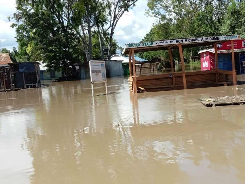
The Ministry of Health has urged counties to step up preparations for the expected El Nino rains, with above-normal rainfall forecast between October and December 2026.
The rains are expected to persist into February 2027, according to the Kenya Meteorological Department, which has put the likelihood of above-normal rainfall at 99 per cent.

The Ministry said all 47 counties have received a health advisory and should put measures in place before the rains begin.
Counties have been directed to ensure health facilities in flood-prone areas remain accessible and are adequately stocked with medicines, vaccines and other essential supplies.
They have also been asked to prepare ambulances and emergency response teams, strengthen disease surveillance and reporting, assess the safety of drinking water and intensify mosquito-control measures.
The Ministry warned that flooding could contaminate water sources and create breeding grounds for mosquitoes, increasing the risk of diseases including cholera, typhoid, malaria, dengue fever and Rift Valley fever.
Flooding could also result in drowning and other injuries, while damage to health facilities could disrupt access to healthcare.
Disruption of food supplies could further worsen food insecurity and increase cases of malnutrition, particularly among children.
The Ministry has also called for uninterrupted health services for vulnerable groups, as well as mental health and psychosocial support throughout the period.
The preparations follow the impact of the 2023–2024 El Nino rains, which affected 43 counties and resulted in 175 deaths, 40 people reported missing and 242 injuries.
A total of 384,216 people were displaced and moved into 170 camps. The Ministry also found that 64 of the 1,434 health facilities assessed across 11 counties became inaccessible.
Areas at higher risk
Counties considered particularly vulnerable include Mandera, Wajir, Marsabit and Garissa in the North Eastern region; Kitui, Makueni and Machakos in the South Eastern region; and Lamu, Kilifi, Kwale, Tana River, Taita Taveta and Mombasa at the Coast.
Other areas identified as being at risk include the Kano Plains in Kisumu, Budalang’i in Busia, the Tana Delta, parts of Murang’a, Nyeri and Meru, the Gusii Highlands, West Pokot and areas along the Rift Valley escarpment that are prone to landslides.
The Ministry said national preparations are being coordinated through the National Public Health Emergency Operations Centre in collaboration with the Kenya Meteorological Department, National Disaster Operations Centre, county governments and other partners.
The World Health Organization, UNICEF, World Food Programme and Kenya Red Cross Society are among the organisations supporting the preparations.
Emergency response teams and laboratories are being readied, while medicines, nutrition supplies, cholera response materials and mosquito-control products are being pre-positioned in areas where they are likely to be needed.
The Ministry has urged counties to complete preparations early to reduce the health risks associated with flooding and ensure essential services remain available throughout the rainy season.