

Authorities in Kisumu are now turning to technology to strengthen the county’s ability to predict, monitor and respond to flooding ahead of the anticipated El Niño rains.
The county is banking on Geographic Information System (GIS) which it says will help provide real-time information on flood-prone areas and guide emergency response.

Kisumu City Manager Abala Wanga says the county is heightening its preparedness in a threefold approach that entails household, community and national government levels, with GIS playing an important role in identifying areas that could be affected and supporting early warning.
Risk Mapping
According to Wanga, the county has mapped several areas within Kisumu City considered vulnerable to flooding.
They include Nyamasaria, Dunga, Namthoya, areas towards Kibos and Chiga, Chido and parts of Amboleo. Manyatta A, Manyatta B with parts of the Central Business District also being assessed.
The mapping is intended to give the county a clearer picture of how flooding could affect people living in these areas and help authorities determine where intervention may be needed.
From a map to real-time information
Wanga says the county is now focusing on making the system more responsive by ensuring information is captured and monitored in real time through the Emergency Operations Centre.
The centre is designed not only to coordinate emergency response, but also to identify and detect potential risks as part of the county’s early-warning system.
This means that as rainfall and flooding conditions change, the county can use updated information to establish which areas are affected and where assistance may be required.
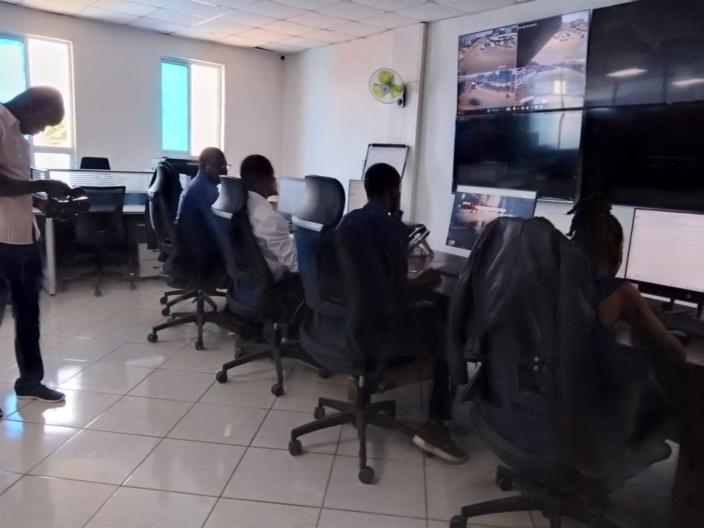
Wanga says teams are expected to map and monitor vulnerable areas as the rains begin, giving the county an opportunity to act on emerging information rather than waiting until flooding has already caused widespread disruption.
Turning data into emergency action
The county’s preparedness plan goes beyond collecting information.
Wanga says Kisumu is strengthening its emergency response capacity, including positioning ambulances, boats and other facilities that can be used during rescue operations.
The emergency response unit is also being strengthened to operate around the clock.
The GIS system can therefore provide the geographical information needed to help emergency teams determine where to concentrate their response when flooding occurs.
Health risks mapped alongside flood risks
Flood preparedness also extends to public health.
The Kisumu CityManager says the Emergency Operations Centre is working jointly with the Department of Health, which will monitor safety and sanitation issues in areas affected by flooding.
He terms this as being significant because flooding can create sanitation challenges, particularly in parts of the city without sewer systems and expose communities to contaminated surroundings thus posing disease related risks.
By incorporating health and sanitation concerns into the response system, the county hopes to address not only the immediate threat of floodwater but also the secondary risks that follow.
GIS informing physical flood-control measures
The data generated through mapping is also expected to support physical flood-mitigation projects.
The county plans to open and improve drainage channels to improve the flow of water and reduce the time floodwater remains in communities and city streets.
In the longer term, Wanga says the county is planning to widen and improve the Nyamasaria River to increase its capacity to carry excess water.
The river receives water from several tributaries, including Uji, Wigwa, Eleura and Kisat, which contribute to the volume of water flowing into Nyamasaria.
The planned intervention is linked to World Bank support, while a GIZ study has informed the proposed improvements.
Who could be affected?
The scale of the potential risk makes accurate and timely information particularly important.
The county estimates that between 150,000 and 200,000 people living in flood-prone areas could be affected by the El Niño rains.
For the county, GIS can help establish where vulnerable populations are located and support decisions on evacuation, emergency response and deployment of essential supplies.
According to Wanga, the Emergency Operations Centre and GIS system are supported by GIZ, UNDP and the County Government of Kisumu, with the city taking up the system as part of its emergency preparedness.
The system is therefore part of a broader preparedness framework that brings together technology, emergency response, health, drainage and disaster management.
Despite the technology and ongoing preparations, Wanga acknowledges that Kisumu cannot claim to be completely prepared for every eventuality.
He says El Niño is a disaster that cannot simply be stopped and that effective preparedness requires significant resources.
The success of the GIS system will therefore depend on what happens after the data is generated.
As the rains approach, the real test will be whether that information can translate into timely warnings, faster decisions and effective action on the ground.