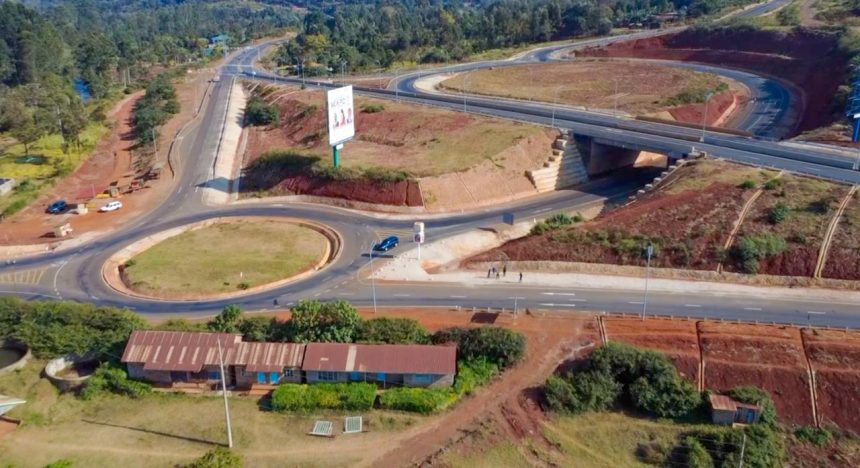
The transformation of Marua from a conventional T-junction into a modern interchange is changing traffic movement in Nyeri, easing congestion while requiring motorists and pedestrians to adapt to a new road configuration.
For residents who have used the route for years, the changes represent a major shift in how traffic moves through the area.

Micky Micky, a resident of Nyeri County, said the interchange had improved traffic flow compared with the previous junction, although some motorists were still finding their way around the new configuration.
“The interchange is good because there is no congestion, but for a motorist coming here for the first time, or someone who knew the old T-junction, it can be confusing.”
He said motorists who had previously been accustomed to making straightforward turns at the T-junction now had to pay closer attention to the new road layout.
The Marwa interchange forms part of the wider transformation of the Kenol-Sagana-Marua corridor, which has significantly changed the movement of traffic between Nairobi and the entire region around the Mount Kenya vicinity.
The upgraded road is providing motorists with a more efficient route while reducing bottlenecks that previously affected movement along the corridor.
“If you are travelling from Nyeri to Nairobi, there is no longer the same congestion.” Micky noted.
However, he said improved infrastructure needed to be accompanied by clear guidance for road users. “They can raise the directional signs and also direct motorists. People do not always look around, so the signs need to be clear.” He added.
While the interchange has improved traffic movement, residents say pedestrian safety should remain part of the next phase of infrastructure and road furniture improvements.
Residents identified the lack of footbridges as one of the challenges facing pedestrians using the busy highway. “We do not have footbridges. It is tricky because there are people with disabilities and people who may be visually impaired.”
The concern highlights the need for road infrastructure to cater not only for motorists but also for pedestrians and other vulnerable road users along the corridor.
As traffic volumes increase along major highways, properly designed crossing points, accessible pedestrian facilities and clear road markings can help communities safely interact with the upgraded roads.
Emmanuel John Ngale, who has worked along the road for about three years, urged drivers to take time to understand the new layout and follow the prescribed directions.
He said observing traffic signs would become increasingly important as motorists familiarise themselves with the upgraded highway.
The road transformation is therefore changing more than the physical appearance of Marua. It is reshaping how motorists navigate the area, how traffic flows and how pedestrians interact with the highway.